

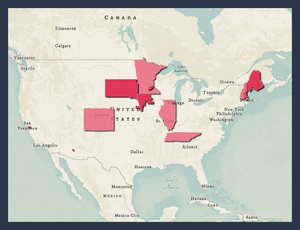
We’re losing 17 ALS Caucus members
NPR reported that more than 10% of Congress is leaving this year, which includes 17 members of the ALS Caucus. Use this map to see if your Legislator is leaving Congress and why.
YOU CAN HELP! Now, more than ever, we need to contact our Legislators and ask them to join the ALS Caucus. Use the Glen Rouse ALS Legislative Viewer to ask your legislators to join the ALS Caucus. For details, see the Contact your Legislators blog.


-
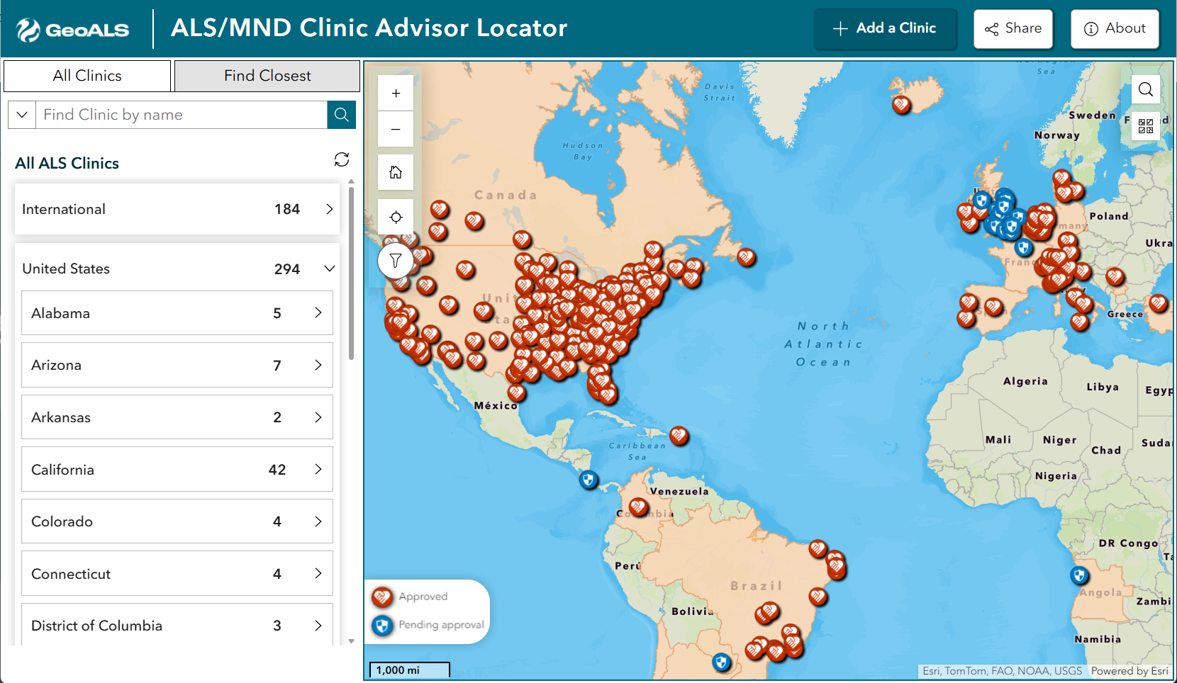
Advisor Locator
Find clinic care based on location using the most complete clinic database in the United States.
-
Advisor Dashboard
Find clinic care based on clinic reviews provided by people with ALS and ALS caregivers.
-
Advisor Survey
The survey is an eye-gaze friendly questionnaire that lets people living with ALS & their caregivers review their clinic.
-
Add an ALS Clinic
Use this form to add a new clinic or a clinic not present in these apps. This form is also in several GeoALS apps.


Our mission is to use GIS to improve care, accelerate research, and advocate for the ALS community.
The seed idea for GeoALS came to founder Pat Dolan just after he was diagnosed with ALS in 2016. Up until 2016, Pat had spent 25 years working with GIS in the utility industry—20 of those years with Esri.
-
After Pat’s diagnosis, he wanted to apply his GIS skills to advance the science of ALS. With the help of his friends at Esri, he developed the ALS Geospatial Hub, which is a platform for advocates and researchers to access maps and apps developed for the ALS community.
Superhuman and tireless ALS Advocate Sandy Morris, whom we devastatingly lost in August 2022, joined forces with Pat in 2021 and brought her team of advocates to support the development of ALS Clinic Advisor and Legislative Viewer. See Sandy’s story on the I Am ALS website.
This group of GIS professionals and advocates are referred to as the Mappers.
GeoALS has nearly the same group of Mappers supporting it today.
In order to sustain this work, Pat founded the nonprofit GeoALS in October 2024. GeoALS is a member of the Esri Nonprofit program, which donated the ArcGIS Platform that powers the ALS Geospatial Hub.